There are about 58 thousand lakes in the Khabarovsk Territory, and there are no more than 20 large lakes among them. A numerous group is formed by floodplain lakes lying in the Amur valley - Orel, Kizi, Hummi, Bolon, Udyl. They are very picturesque, rich in fish and are home to many species of waterfowl. The coastal areas of a number of lakes are landscaped and are popular recreation and sports entertainment areas. Among them are Khrustalnoe, Blagodatnoe, Amut, Haka.
The water bodies of the region are inhabited by about 100 species of fish. Such a rich aquatic fauna and ecological purity of local waters attracts inveterate fishing enthusiasts from all over the Far East. Some of the bodies of water are officially considered fishing grounds. The unique ecosystems of many lakes in the Khabarovsk Territory are protected by the state.
The best lakes in the Khabarovsk Territory
List of the most famous and popular lakes in the region.
Bologne
Lake in the Amur region. It lies in the floodplain of the Amur and is connected with it by two channels. Area - 338 km2... The average depth is up to 4 meters. There are several islands, the most famous - Yadasen and Giudelgen - of volcanic origin. The lake is one of the most important migration centers for numerous migratory birds. It is famous for its rich variety of fish, represented by 52 species, and is a spawning ground for salmonids. In the southern part there is the Bologna Nature Reserve.

Chukchagirskoe
A large body of water in the area of Polina Osipenko. Area - 366 km2... Belongs to the Amgun river basin. It has many islands, including floating ones. The largest - Dzhalu and Godbanki - divide the lake into 3 parts. The greatest depth is 6 meters. Recently, there has been an intensive process of waterlogging. Many species of birds stop here to rest and nest. A popular recreation and fishing area among locals. The village of Chukchagir is located on the shore.

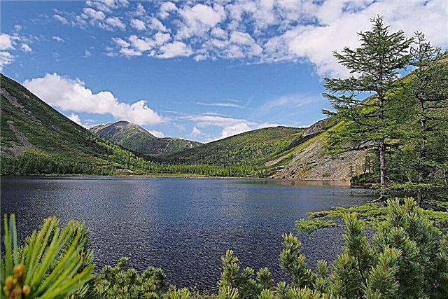
Amut
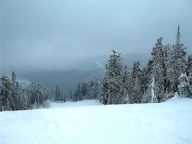
A picturesque mountain lake on the territory of the Solnechny district, near the village of Gorny. Located at an altitude of 760 meters, on the Miao-Chan ridge. It appeared as a result of a large landslide that blocked the Amut River. It is 450 meters long and 130 meters wide. Natural monument. Lies surrounded by hills covered with age-old spruce and dwarf cedar. A popular destination for alpine skiing enthusiasts. There are many guest houses and recreation centers in the vicinity.

Korbokhon
Mountain lake on the Dusse-Alin ridge, part of the Bureinsky reserve. The origin is glacial. Located in a hard-to-reach place, at an altitude of 1160 meters. The lake is 600 meters long and 400 meters wide. Depth - up to 14 meters. A distinctive feature of the reservoir is the black tint of the water, due to the specific structure of the bottom. The aquatic fauna is of interest - a unique goggle-eyed lenok lives here, as well as a relict loach-Davatchan.

Bearish
The pearl of the mountainous area of the Verkhnebureinsky region. Lies at the bottom of a stone cauldron, at an altitude of 1.6 km, near the Dusse-Alin mountain peaks. On 3 sides it is surrounded by sheer granite rocks up to 400 meters high. Most of the year covered with ice, no fish. The water is beautiful blue. The Red Book rhododendron of Redovsky grows in the vicinity. The reservoir belongs to the Bureinsky Reserve. To visit it requires permission from the administration.

Lotus lake
Landmark of the Khabarovsk region. Located near the village of Galkino. The place of growth of a relict aquatic plant from the Red Book - the Komarov lotus. The flowering time begins after July 20 and lasts about 2 weeks. At this time, it is especially crowded here, although the road to the reservoir is not in the best condition. Tourists can visit the lake in organized groups accompanied by a guide. In the future, it is planned to create a comfortable recreation area here.

Petropavlovskoe
Located in the Khabarovsk region. It is communicated through several channels with the Amur River. The shores are mostly swampy, only in the eastern part rocky rocks protrude to the surface, forming the Peter and Paul Cliff. The reservoir is rather shallow and dries up in dry years. The Sita River and several streams flow into it. On the banks there are children's and student camps, as well as the villages of Petropavlovskoye, Svechino, Konstantinovka.

Haka
An artificial picturesque lake on the territory of the Lazo district, near the villages of Khor and Khaka. It was formed on the site of an old spent quarry for the extraction of gravel. The water is clear, the banks are covered with dense forest vegetation. The depth reaches 11 meters. A popular recreation center of the same name is located on the lake. For visitors are offered cozy houses, a hotel, gazebos, a cafe, a sauna, sports equipment rental.

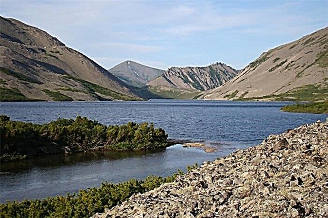
Big Suluk
Mountain lake in the Verkhnebureinsky region. Lies in the center of the Bureinsky ridge, in a depression of tectonic origin, at an altitude of 1331 meters. The maximum depth reaches 30 meters. A house for tourists was built on the shore. Weekly tours to the lake are popular, including quad biking, catamaran trips, an excursion to the neighboring lake Maly Suluk, fishing, climbing the highest peaks of the ridge.

Evoron
A relict lake on the territory of the Solnechny district, 6 km from the village of Evoron. Area - 194 km2... The average depth does not exceed 3 m. The Evur River flows into the lake, and the Nine flows out of it. Evoron is an important site for the seasonal migration of birds. It is rich in fish, fishing is conducted on an industrial scale. The surroundings of the reservoir have long been inhabited by the indigenous Nanai. An ethnographic museum has been created in the national village of Kondon on the banks of the Nine River. Excavations are underway.

Sindinskoe
Lake in the Nanai region, in the Amur valley. It was named after the Nanai village of Sinda. The village of Mayak is located on the eastern bank. The lake is connected with the Amur through the Sindinskaya channel, across which a road bridge is built. Shallow water, rich in fish resources. Commercial fishing is carried out. Several rivers flow into the lake - Ton, Nemta, Bakhta. Large colonies of beavers can be found there. A fish breeding shop was established on the Bakhta River.

Dredge
Located in the vicinity of the village of Pereyaslavka, on the territory of the district named after Lazo. It is of artificial origin. It is surrounded by forest on all sides. On the coastline there is a recreation center offering comfortable accommodation in houses or hotel rooms, beach holidays, fishing, active entertainment, playgrounds, picnic gazebos. In winter, cold swimming competitions are held on the lake.

Gussie
Lake in the territory of the Nanai region. Partially belongs to the Anyui National Park. It is located on the right bank of the Amur and is connected to it by means of the Gassinsky channel. Depth - 3-4 meters. One of the brightest representatives of the lake ichthyofauna is the Red Book Far Eastern turtle. Gussie is the northernmost place of her habitat. Also, quite rare mollusks were found in the lake - the Kian amuranodont and the Daurian pearl mussel.
Udyl
A large, but rather shallow lake near the left bank of the Amur, in the Ulch district. It is connected to the river by the Ukhta channel. Average depth - 2-3 meters, maximum - 5 meters. Area - 330 km2... Several rivers flow into the lake - Bichi, Bitki, Pilda. In the place of their confluence there is a natural reserve Udylsky. It was created with the aim of preserving local wetlands and their birds. An Early Neolithic site was discovered on the coast.

Big Kesey
The lake in the Ulch district, in the northern and southern parts, is surrounded by low mountains. Lies in the right-bank floodplain of the Amur. It is connected to the river by several channels. Area - 280 km2, depth - 3-4 meters. A small strip of land separates the reservoir from the Tatar Strait.In the future, it is planned to build a navigable canal in this place. There are several villages along the shores of Bolshoy Kizi - Chilba, Kizi, Tulinskoye, Bolshie Sanniki.

Orel
Located on the territory of the Nikolaev area. It connects with the Amur near the channel. It is replenished by precipitation and several flowing rivers - Japi, Bekchi. Area - 314 km2, the maximum depth is 3.8 meters. The shores are mostly covered with larch forests. The Priozerny hunting reserve has been created in the western part. The reservoir is rich in fish; numerous waterfowl nest in the vicinity. The village of Orel-Chlya is located on the shore.

Hummi
It is located on the territory of the Komsomolsk region, in the right-bank floodplain of the Amur, with which it is connected by several channels. Area - 117 km2, the maximum depth is up to 4 meters. The bottom is silty, sometimes rocky or sandy. The banks are covered with forest vegetation. The lake is rich in fish, there are species listed in the Red Data Book - black carp, sima, black bream, perch-aukha. The village of Selekhino and a tourist base are located on the shore of the reservoir.

Chlya
Located on the territory of the Nikolaev region. It communicates with the Amur through the Glinskaya river and with the Orel lake using the Podgornaya river. The maximum depth is no more than 2.6 meters. The banks are steep, covered with forests, in the southwest - swampy. Area - 140 km2... There are a lot of fish in the lake; chum salmon are caught on an industrial scale. The village of the same name is located on the coast. A porcelain stone deposit is being developed nearby.

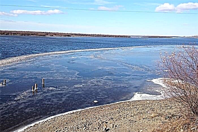
Kadi
A lake in the Ulchsky region, in the northern part of the Sikhote-Alin, on the right bank of the Amur. Square - 67 km2, but this figure is unstable and directly depends on the water level in the Amur. The shores of the reservoir are mostly low-lying and swampy. The bottom is muddy in places. The river of the same name flows into Kadi, and the Amurkan flows out - the river connecting the lake with the Amur. It is famous for its notable fishing. In commercial terms, Pacific salmon are of the greatest value.

Dalzha
It is located on the territory of the Ulch district. It communicates with the Amgun River - a tributary of the Amur - through Lake Dalgan. Area - 61 km2... The lake has a fishing value. Navigable for small vessels. A natural monument, partly part of the Dalzhinsky nature reserve. On its territory, the habitats of elk, nesting of rare birds and the growth of Red Book plants are protected. Archaeological excavations are being carried out along the shores of the reservoir.

Muhtel
It is located on the shores of the Sea of Okhotsk Bay, with which it communicates through a channel. Dozens of rivers flow into the reservoir, the largest is Mukhtel. Square - 28 km2, depth - up to 4 meters. The lake and its surroundings are characterized by a high number of birds and mammals, including marine ones. Refers to the nature reserve of the same name. The preservation of the ecosystem of the reservoir is largely due to its inaccessibility. Distance to the village of Mnogovershinny - 60 km.

Blagodatnoe
An artificial lake in the Khabarovsk region, in the valley of the Sita river, with which it communicates through a channel. It was formed at the end of the last century as a result of gravel mining. Named after the coastal village. A popular area for beach lovers, water sports, fishing. In winter, motorcycle and auto racing competitions are held on the ice. Gravel continues to be mined in the vicinity, there is a possibility of the formation of such reservoirs.

Baikalenok
Mountain lake on the territory of the Dzhugdzhur reserve in the Ayano-May region. It is of glacial origin. Lies surrounded by rocks at an altitude of 836 meters, resembles Baikal in shape. The water is very clear and cool, even in summer its temperature does not exceed 13 ° C. The mountain river Batomga flows out of the lake. The banks are covered with dense thickets of blueberry. There is excellent fishing, mountain black grayling and river goby are especially good.
Crystal
A beautiful artificial lake formed on the site of a former industrial quarry. It is located in the Solnechny district, between the village of Solnechny and Komsomolsk-on-Amur. It owes its name to the amazingly clear water. There are many fish in the lake and crayfish. A popular recreation center of the same name is located on the shore. There is a landscaped beach area, including for children, equipped with fishing and picnic areas.

Dabanda
Located 7 km from the village of Krasny Yar. Belongs to the Amur basin, is located on its left bank, communicates through a channel. Reservoir area - 12.2 km2... Popular with numerous fishing enthusiasts. The legend of the water dragon of Lake Dabanda named Siimur still circulates among the local residents. He looked like a huge crocodile, lured hunters to the shores of the reservoir and swallowed into his insatiable womb.